


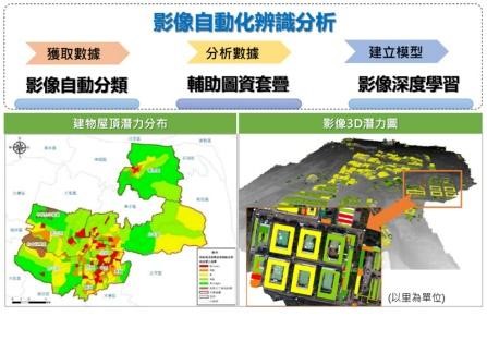
Interpretation and analysis of green energy image on building roofs
The unmanned vehicle can take high-resolution orthophoto images, analyze factors such as floor shading, grid-connected capacity, and sunlight environment, and improve efficiency and accuracy through AI automatic image recognition, which can be used as a reference for evaluating roof potentials.
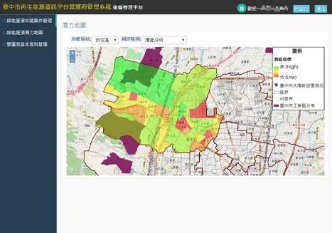
Potential map of green roofs
To collect potential data on relevant buildings, topography, electricity, etc., and count the roofs of buildings that can potentially be installed with renewable energy. After layer overlay analysis, areas with high development potentials are prioritized as demonstration areas.。
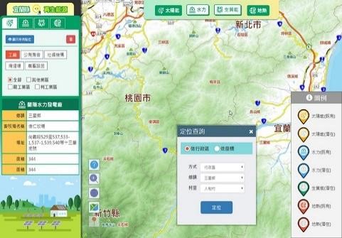
Renewable energy map
By using GIS spatial display map and attribute table inventory to build a green roof potential map, you can query the spatial distribution of energy potential areas. The content of the map will include information such as potential analysis, shading status, feeder status, and solar installation status.