


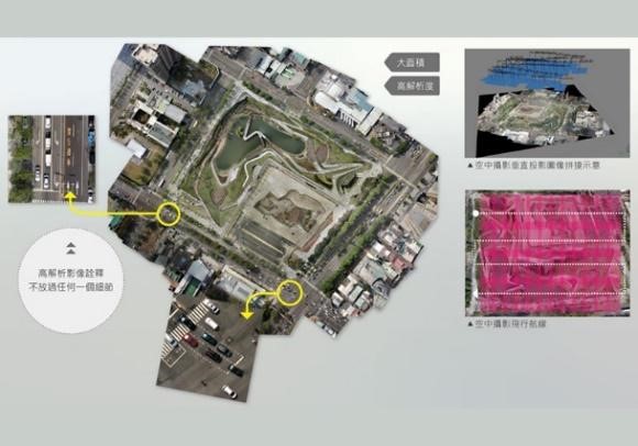
Ortho-photographic shooting services
It uses route planning for autonomous flight, and coordinates measurement of high-precision ground control points to perform three-dimensional coordinate adjustment and correction of images to create high-resolution and high-precision orthophotos.
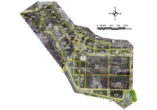
High-resolution aerial photography and value-added applications
It extracts the geometric spatial information of the ground surface by means of aerial measurement, and overlays various types of maps such as cadastral maps and land use maps, to produce clear and accurate ground truth information, and to provide the basis for geographic information analysis and judgment and decision-making.
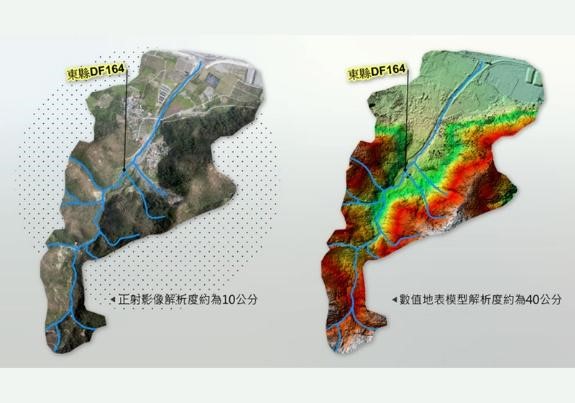
Numerical surface model
Through aerial image data, a high-precision display of three-dimensional topographic fluctuations is built to accurately present the three-dimensional shape of the surface.
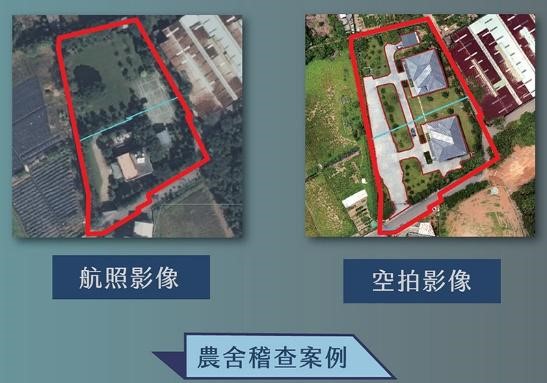
Smart image interpretation of illegal farmhouses
By employing multi-scale imaging technologies such as remote sensing detection, aerial photos, and unmanned aerial vehicles, and with the assistance of collecting multi-scale image data, it enables to master survey images of various scales and different periods of time, and perform image value-added judgments.
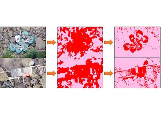
AI automatic interpretation of marine debris
By combining images with AI automatic image interpretation technology, it can be used in large-scaled image interpretation applications such as violation audit works, potential or disaster damage analyses.
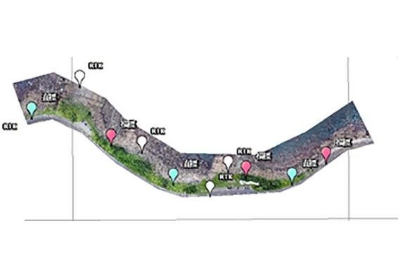
Multi-spectral image analysis of coastlines
If an unmanned aerial vehicle is equipped with a multi-spectral sensor, high-resolution multi-spectral images with higher spatial, the temporal and spectral resolution can be obtained, and the complex photoreaction can be transformed into a section of spectral lines to present the identification of the spectral response of crops. This device is suitable for remote sensing image recognition applications such as precision agriculture, vegetation monitoring, land object classification and plant adversity detection.